
tóng-àn:Estonia municipalities.png

Seng khoàⁿ chiàm-liōng: 800 × 513 siōng-sò͘. Kî-thaⁿ--ê kái-sek-tō͘: 320 × 205 siōng-sò͘ | 640 × 411 siōng-sò͘ | 1,024 × 657 siōng-sò͘ | 1,280 × 821 siōng-sò͘ | 1,601 × 1,027 siōng-sò͘.
Choân kái-sek-tō͘ (1,601 × 1,027 siōng-sò͘ , tóng-àn chiàm-liōng: 82 KB, MIME luī-hêng: image/png)
|
|
Che sī tùi Wikimedia Commons ín--lâi ê chi̍t hūn tóng-àn. I tī hia ê kì-su̍t-ia̍h téng-bīn ê chu-sìn hián-sī ùi ē-té. |
Khài-iàu
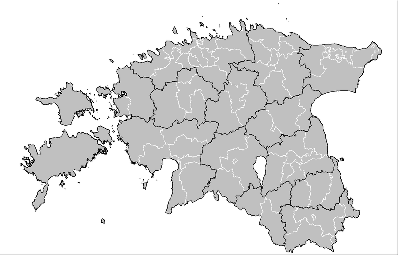
| Soat-bêng | Map of the municipalities of Estonia after the 2017 municipal reform. Created by Rarelibra 15:43, 20 December 2006 (UTC) for public domain use, using MapInfo Professional v8.5 and various mapping resources. |
| Ji̍t-kî | 2006年12-goe̍h20日 (原始上傳日期) |
| Chhut-chhù | No machine-readable source provided. Own work assumed (based on copyright claims). |
| Chok-chiá | No machine-readable author provided. Rarelibra assumed (based on copyright claims). |

|
本圖片是以PNG、GIF或JPEG格式上傳。然而,其中包含的資料或訊息,應該重新建立成可縮放向量圖形(SVG)檔案,以更有效率或更準確的方式儲存。如有可能,請上傳本圖片的SVG格式版本。在上傳之後,請修改維基各姊妹計畫中所有使用舊版圖片的條目(列在圖像連結章節中),替換為新版圖片,並在舊圖片的描述頁中加入{{Vector version available|新圖片名稱.svg}}模板,同時移除本模板。
|
Siū-khoân
| 我,此作品的版權所有人,釋出此作品至公共領域。此授權條款在全世界均適用。 這可能在某些國家不合法,如果是的話: 我授予任何人有權利使用此作品於任何用途,除受法律約束外,不受任何限制。 |
Tóng-àn le̍k-sú
Chhi̍h ji̍t-kî/sî-kan, khoàⁿ hit sî-chūn--ê tóng-àn.
| Ji̍t-kî/Sî-kan | 細張圖 | 寸尺 | Iōng-chiá | Chù-kái | |
|---|---|---|---|---|---|
| hiān-chāi | 2019-nî 4-goe̍h 8-ji̍t (pài-it) 19:50 | | 1,601 × 1,027(82 KB) | H2ppyme | Fixed Kohila Parish |
| 2017-nî 12-goe̍h 8-ji̍t (pài-gō·) 14:51 |  | 1,601 × 1,027(72 KB) | RoMex | Updated according to the 2017 municipal reform. | |
| 2017-nî 3-goe̍h 10-ji̍t (pài-gō·) 07:33 |  | 1,601 × 1,027(102 KB) | H2ppyme | Corrected borders of Põlva and Rakvere parishes and Võhma Town. | |
| 2015-nî 1-goe̍h 4-ji̍t (lé-pài) 01:44 |  | 1,601 × 1,027(122 KB) | Flying Saucer | updated Lääne-Saare Parish | |
| 2013-nî 10-goe̍h 25-ji̍t (pài-gō·) 23:35 |  | 1,601 × 1,027(122 KB) | Flying Saucer | October 2013 updates | |
| 2010-nî 9-goe̍h 2-ji̍t (pài-sì) 12:30 |  | 1,601 × 1,027(110 KB) | H2ppyme | Kaisma Parish merged with Vändra Parish | |
| 2008-nî 3-goe̍h 24-ji̍t (pài-it) 13:40 |  | 1,601 × 1,027(76 KB) | Rarelibra | updated map style | |
| 2007-nî 1-goe̍h 8-ji̍t (pài-it) 17:39 |  | 1,281 × 878(56 KB) | Rarelibra | Updated map of the municipalities of Estonia (due to 2006 updates). | |
| 2006-nî 12-goe̍h 20-ji̍t (pài-saⁿ) 15:43 |  | 1,281 × 878(41 KB) | Rarelibra | Map of the municipalities of Estonia. Created by ~~~~ for public domain use, using MapInfo Professional v8.5 and various mapping resources. |
Iáⁿ-siōng liân-kiat
Í-hā ê ia̍h liân kàu chit ê iáⁿ-siōng:
tóng-àn hō͘ lâng sái--ê chōng-hóng
Ē-kha--ê kî-thaⁿ wiki ēng tio̍h chit--ê tóng-àn:
- ar.wikipedia.org hō͘ lâng ēng--ê chêng-hêng
- arz.wikipedia.org hō͘ lâng ēng--ê chêng-hêng
- ba.wikipedia.org hō͘ lâng ēng--ê chêng-hêng
- bn.wikipedia.org hō͘ lâng ēng--ê chêng-hêng
- bs.wikipedia.org hō͘ lâng ēng--ê chêng-hêng
- ca.wikipedia.org hō͘ lâng ēng--ê chêng-hêng
- ceb.wikipedia.org hō͘ lâng ēng--ê chêng-hêng
- cs.wikipedia.org hō͘ lâng ēng--ê chêng-hêng
- da.wikipedia.org hō͘ lâng ēng--ê chêng-hêng
- de.wikipedia.org hō͘ lâng ēng--ê chêng-hêng
- el.wikipedia.org hō͘ lâng ēng--ê chêng-hêng
- en.wikipedia.org hō͘ lâng ēng--ê chêng-hêng
- et.wikipedia.org hō͘ lâng ēng--ê chêng-hêng
- Eesti
- Eesti külade loend
- Arutelu:Eesti
- Eesti haldusüksuste lippude loend
- Eesti haldusjaotus
- URBACT
- Eesti regionaalpoliitika
- Eesti omavalitsuste haldusreform
- Eesti haldusüksuste vappide loend
- Vikipeedia arutelu:Vikiprojekt KOV 2017
- Kasutaja:Telempe/Mall:KOV2017
- Mall:Eesti maakondade lippude kaart
- Mall:Eesti maakondade vappide kaart
- fa.wikipedia.org hō͘ lâng ēng--ê chêng-hêng
- fiu-vro.wikipedia.org hō͘ lâng ēng--ê chêng-hêng
- fi.wikipedia.org hō͘ lâng ēng--ê chêng-hêng
- fr.wikipedia.org hō͘ lâng ēng--ê chêng-hêng
- hu.wikipedia.org hō͘ lâng ēng--ê chêng-hêng
- it.wikipedia.org hō͘ lâng ēng--ê chêng-hêng
- ja.wikipedia.org hō͘ lâng ēng--ê chêng-hêng
- ka.wikipedia.org hō͘ lâng ēng--ê chêng-hêng
- la.wikipedia.org hō͘ lâng ēng--ê chêng-hêng
- mk.wikipedia.org hō͘ lâng ēng--ê chêng-hêng
- my.wikipedia.org hō͘ lâng ēng--ê chêng-hêng
- nl.wikipedia.org hō͘ lâng ēng--ê chêng-hêng
- nn.wikipedia.org hō͘ lâng ēng--ê chêng-hêng
- no.wikipedia.org hō͘ lâng ēng--ê chêng-hêng
檢視此檔案的更多全域使用狀況。